Kôprovský štít 2024
Kôprovský Peak, High Tatras
2024/08
Slovakia 
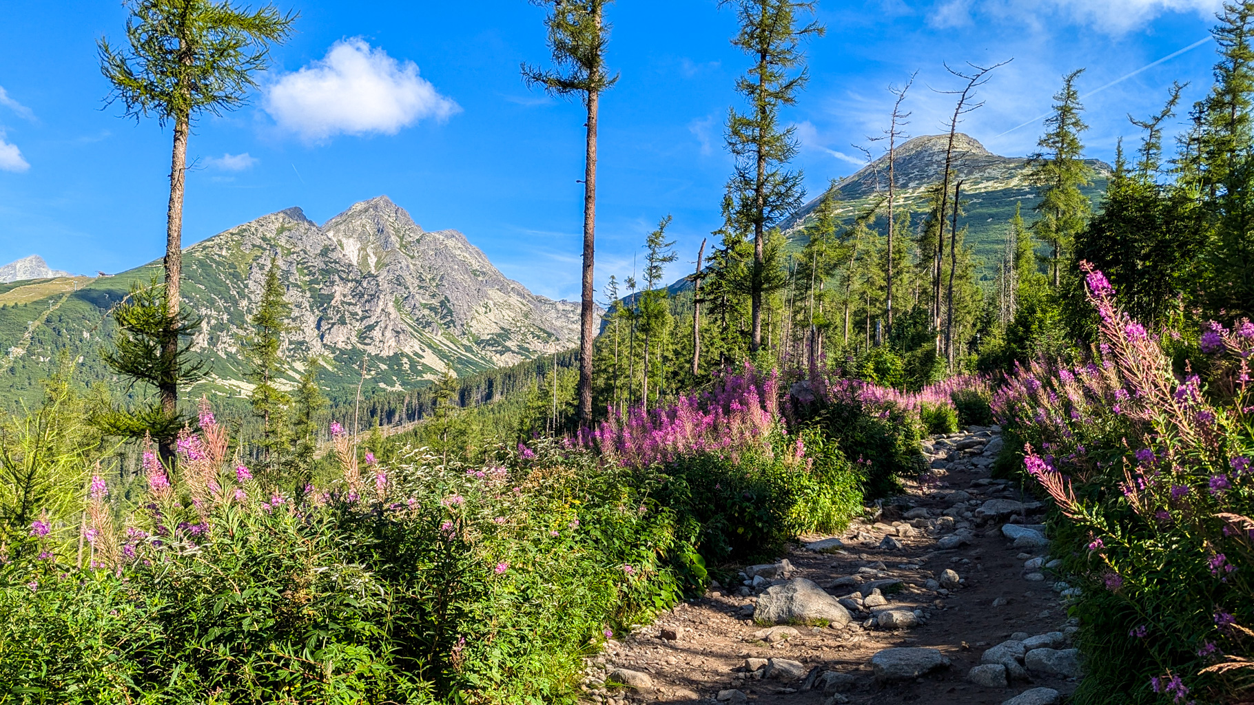
Photo 1: Trail from Štrbské Lake to Popradské Lake, surrounded by blooming flowers with views of Patria (2,203 m) and Predné Solisko (2,093 m).
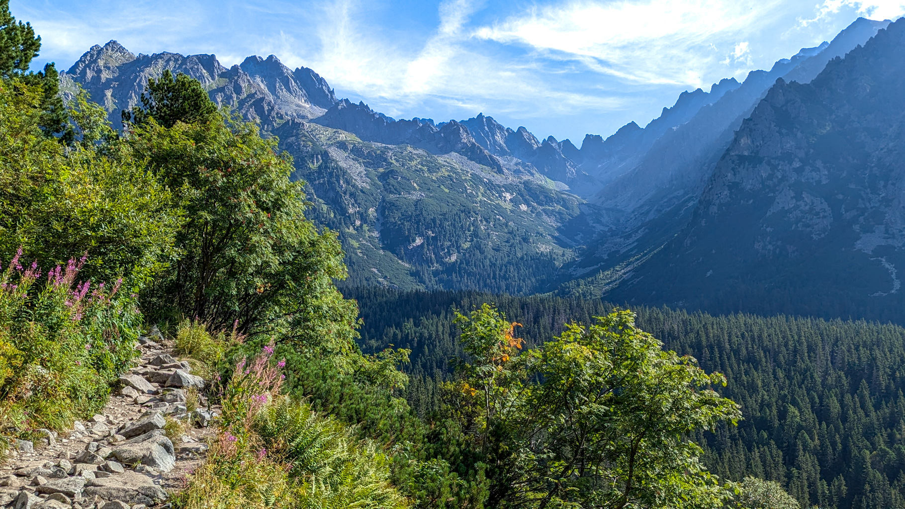
Photo 2: Trail heading to Popradské Lake, with views of Kôpky, Vysoká, Zlobivá, Východný Železný Peak, Popradský Ľadový Peak, Končistá, Tupá and other peaks above the Zlomisková valley.
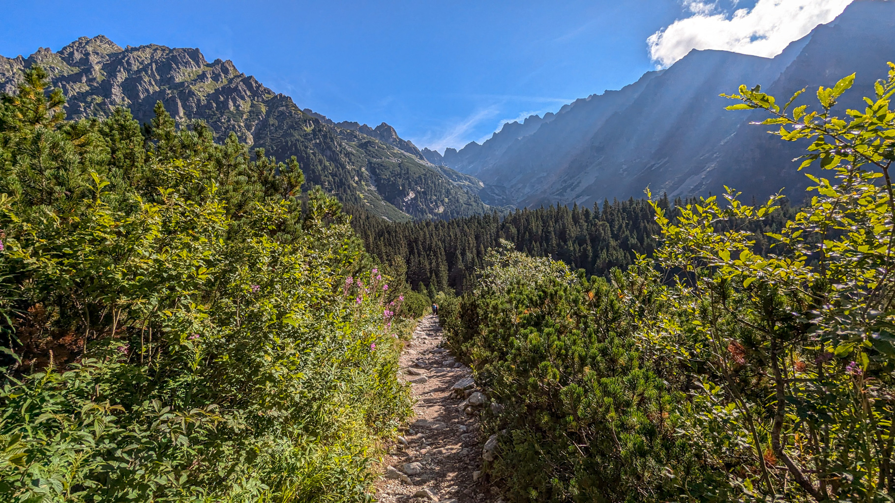
Photo 3: Trail leading to Popradské Lake, surrounded by dwarf pines, with a view of the Tatra peaks above the Zlomisková valley.
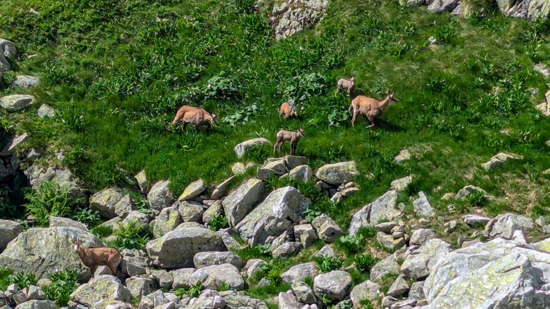
Photo 4: A herd of Tatra chamois on the ascent to Hincovo Lake – typical inhabitants of the rocky Tatra slopes.
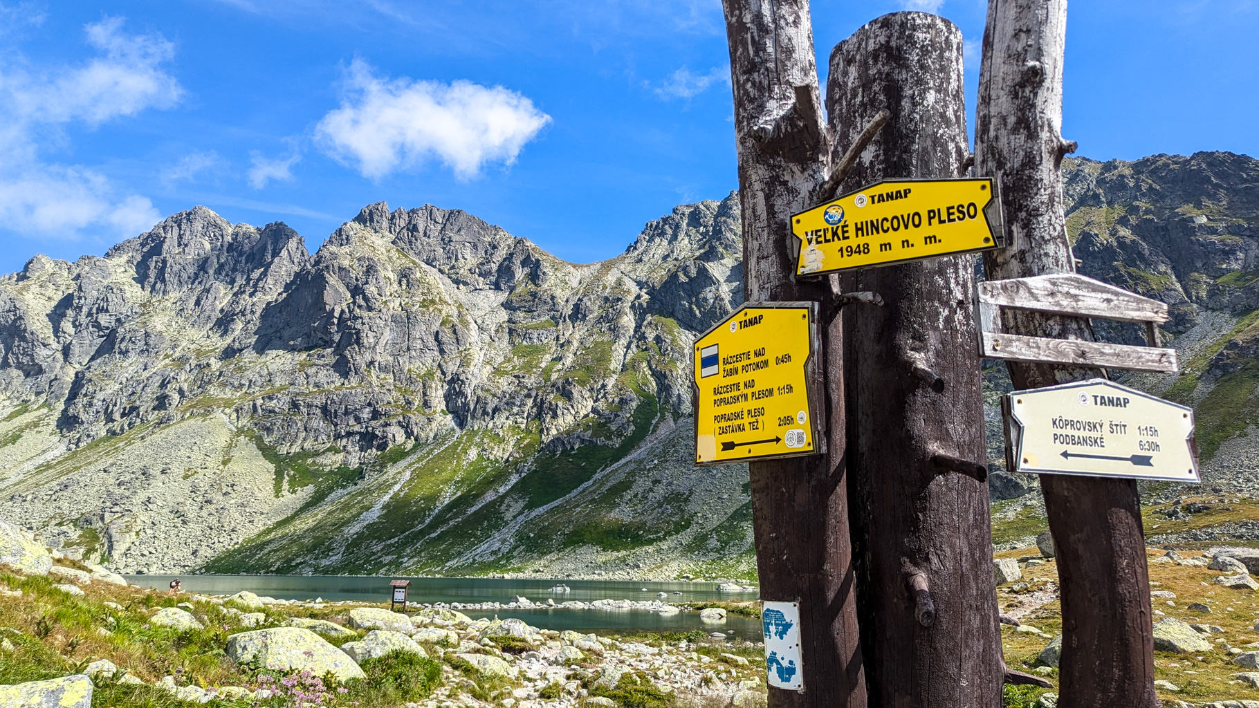
Photo 5: Trail signs at Veľké Hincovo Lake (1,948 m), a junction of routes towards Kôprovský Peak, Podbanské or back to Popradské Lake.
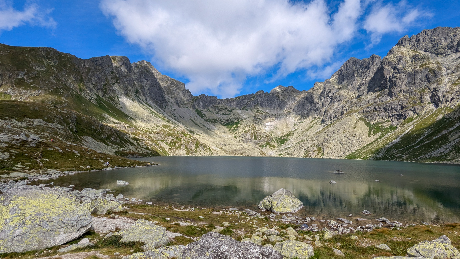
Photo 6: Veľké Hincovo Lake – the largest and deepest lake on the Slovak side of the Tatras (20.1 ha, depth 53 m), situated at the head of the Mengusovská valley.
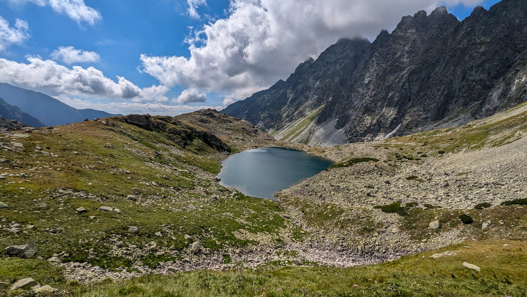
Photo 7: Malé Hincovo Lake lies beneath the rocky walls of the Hrebeň Bášt ridge in the Mengusovská valley.
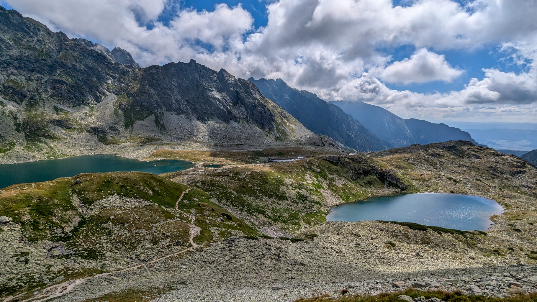
Photo 8: Malé and Veľké Hincovo Lake seen from the trail below Kôprovské Saddle, surrounded by the rocky walls of the Mengusovská valley.
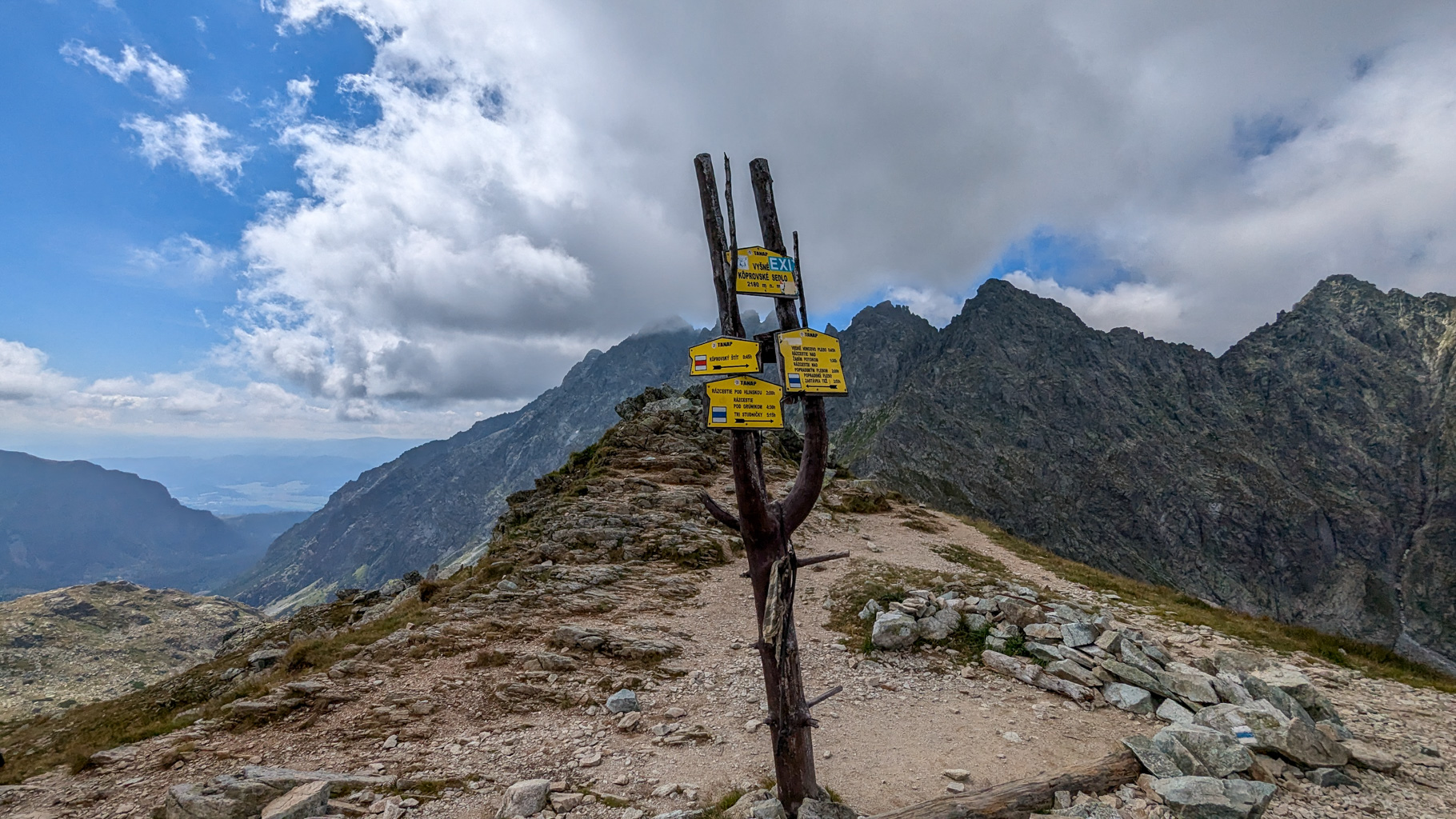
Photo 9: Vyšné Kôprovské Saddle (2,180 m) – an important mountain pass between the Mengusovská and Hlinská valleys, a popular hiking junction in the High Tatras.
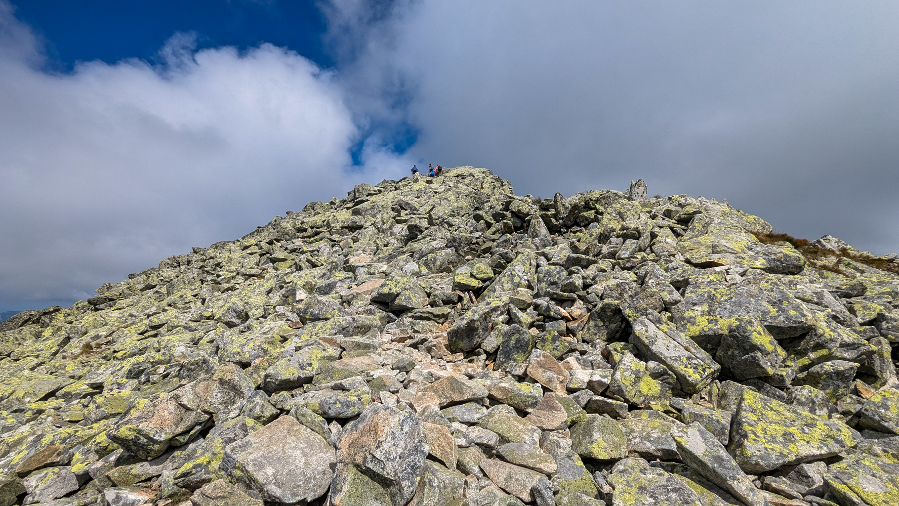
Photo 10: Final ascent to the summit of Kôprovský Peak over rocky scree – to one of the finest viewpoints in the High Tatras (2,363 m).
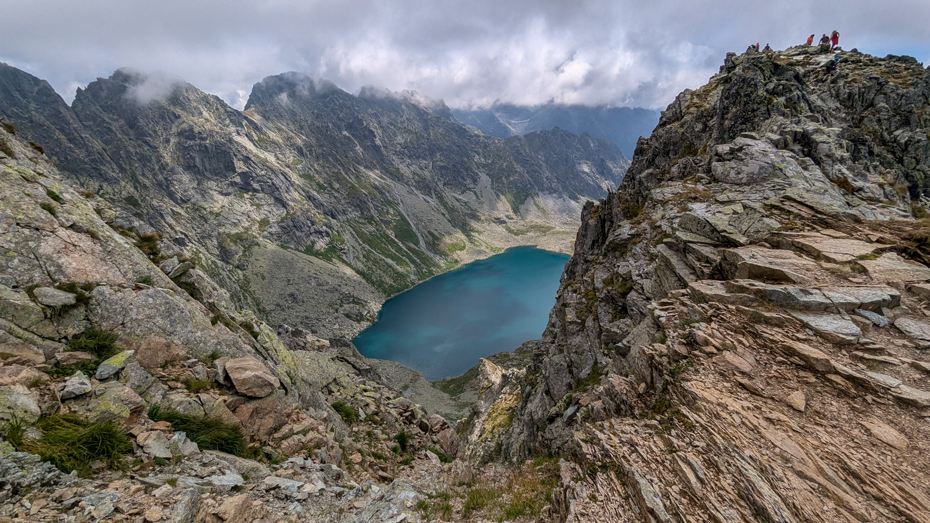
Photo 11: View of Veľké Hincovo Lake from near the summit of Kôprovský Peak – a turquoise lake surrounded by the rocky walls of the Mengusovská valley.
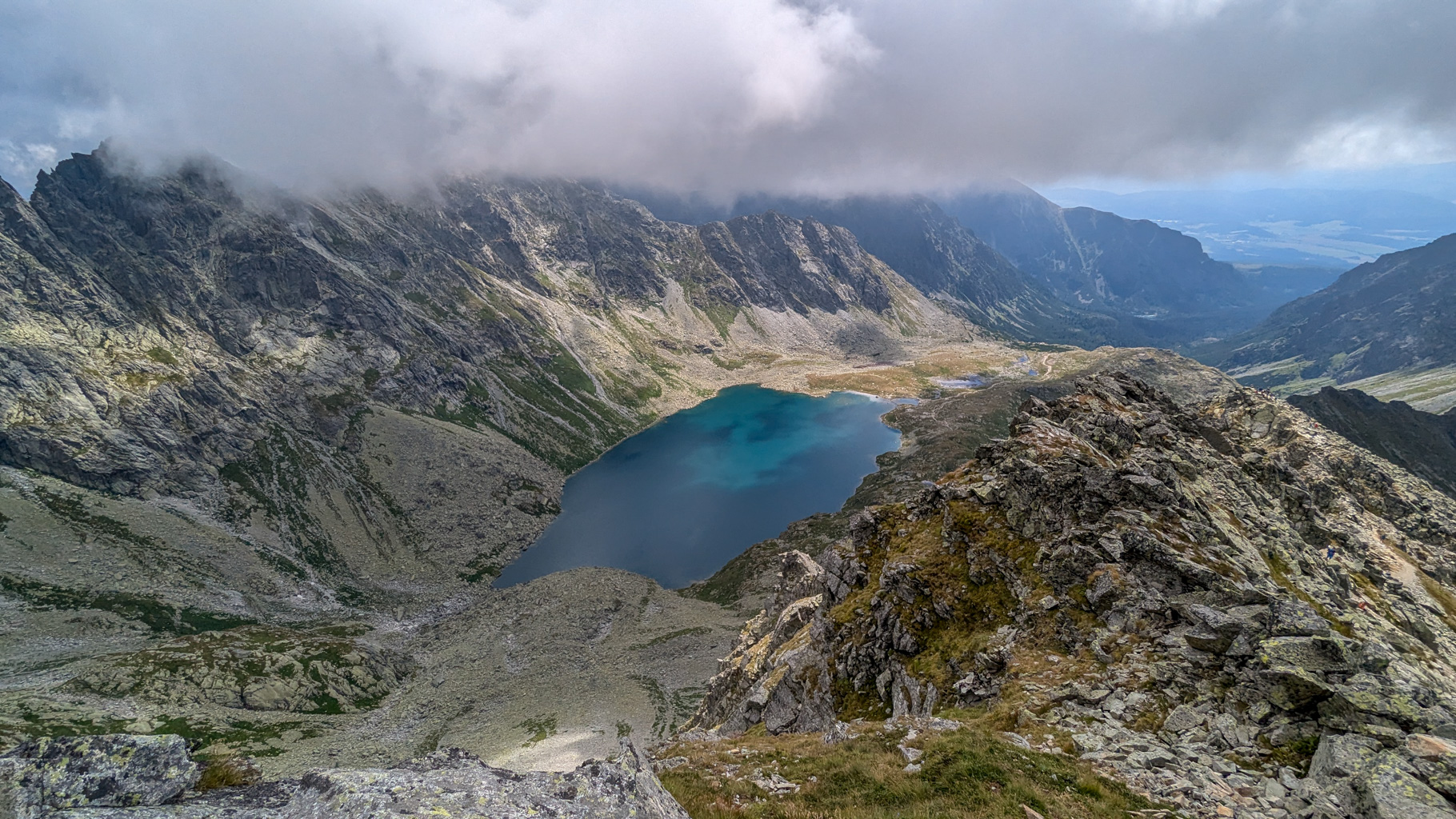
Photo 12: View from Kôprovský Peak into the Mengusovská valley, dominated by Veľké Hincovo Lake with the Mengusovské peaks shrouded in clouds behind.
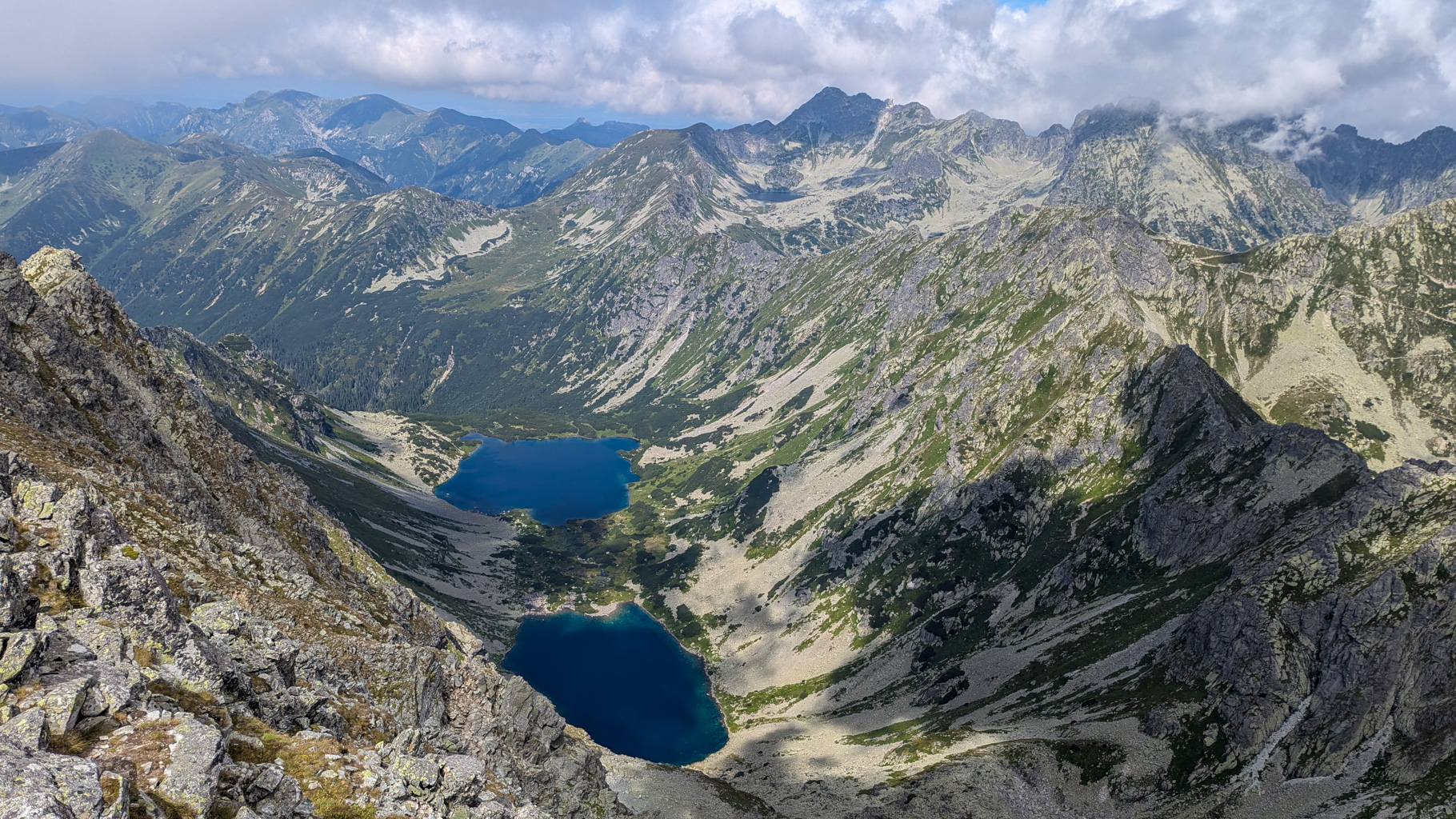
Photo 13: Panoramic view from the summit of Kôprovský Peak of the Temnosmrečinské Lakes with part of the Polish Tatras in the background.
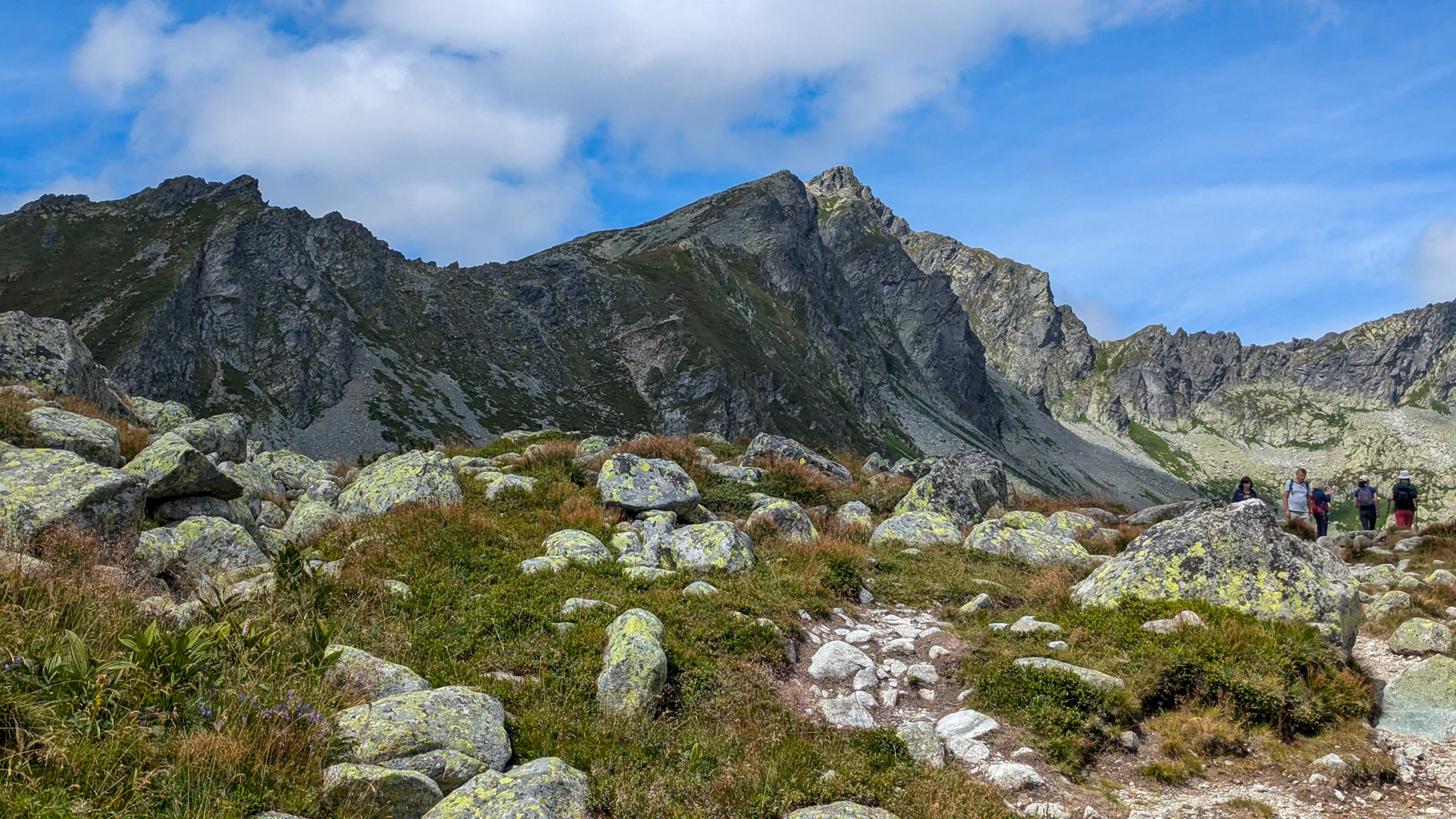
Photo 14: View of Kôprovský Peak during the descent – looking back at the rocky ridge along which the hiking trail leads to the summit (2,363 m).